Iceland volcano: Peninsula faces ‘decades’ of instability
Iceland’s south-western peninsula could face decades of volcanic instability, warns the Icelandic Met Office (IMO).
Earthquakes and fears of an impending eruption have led to the evacuation of the small fishing town of Grindavik.
After an 800-year hiatus, eruptions on the Reykjanes Peninsula began again in 2021, which may mark a new “eruptive cycle”, the IMO’s Matthew Roberts says.
“We expect to see volcanic eruptions along the peninsula, not just repeatedly in the same location.”
This instability, he adds, could last decades.

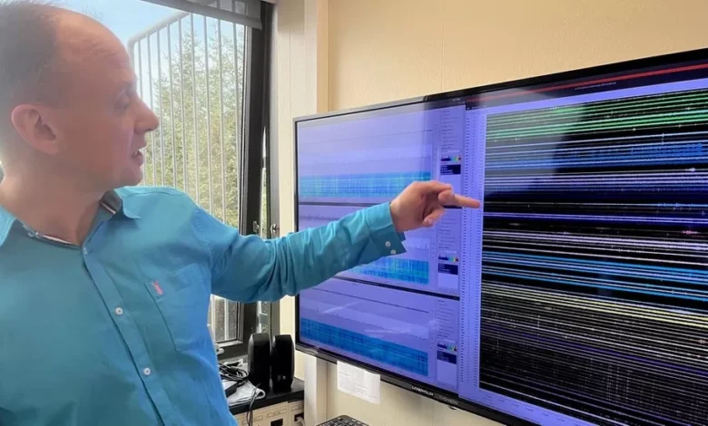
Dr Roberts, who is a managing director in the IMO’s Reykjavik headquarters, takes us into a room where staff are intensely monitoring seismic activity 24 hours a day.
Last Friday, the team were shocked to realise magma was coursing into the ground, fracturing rock over a distance of 15km (nine miles).
It cut beneath Grindavik “almost like an underground freight train”, says Dr Roberts. A phenomenon unknown in modern times.
The order was quickly given to evacuate, and soon after stark images began emerging of severely cracked roads and damaged houses following repeated earthquakes.
The town will continue to subside, Dr Roberts says, exacerbating damage to buildings and roads.
The western part of Grindavik has sunk by more than a metre (3.3ft) since last Friday, and continues to do so at a rate of about 4cm (1.6in) a day.

A colour map shows the recent levels to which land has collapsed and in one area the situation remains “highly volatile”, with an eruption likely within days or weeks.
If there is an eruption, there could be significant damage to local infrastructure and a release of toxic fumes.
Fascinatingly, aerial photographs suggest that the magma is running underneath a previous, centuries-old, visible fissure.
“The magma intrusion is exploiting this exact same location again,” says Dr Roberts.
Iceland is very used to volcanic activity because it sits over the Mid-Atlantic Ridge. The Eurasian and North American plates are pulling apart from each other, a few centimetres each year.
But this kind of evacuation of an entire community has not happened in 50 years.
In 1973, a fissure started spouting molten red lava on Heimaey, the largest of Iceland’s Westman Islands.
Currently, within the Reykjanes Peninsula, it is estimated that the magma is now sitting about 800m (0.5 miles) beneath the surface.
Residents may have to wait for weeks, at least, before it is clear whether they can return to the area.
“We’re not expecting an explosive eruption,” says Dr Roberts, although that is not necessarily a good thing.
A low-intensity eruption could mean lava pouring from a series of fissures over weeks and weeks.
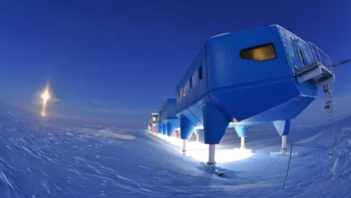
“If that were to occur there would be lava flow to the south – possibly towards Grindavik – and also possibly north and westwards” towards the Svartsengi power station and Blue Lagoon, says Dr Roberts.
Contingency plans include protective barriers – known as “levees” – which are being built near the geothermal plant while the famous Blue Lagoon spa remains closed.
Iceland has all sorts of ingenious ways to fight lava, says Dr Roberts, but “nature always wins if the eruption is long enough”.