England’s hedges would go around Earth ten times
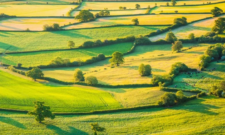
England’s hedgerows would stretch almost ten times around the Earth if lined up end to end.
That’s according to a new map – the most comprehensive to date – of these historic features of the landscape.
Ecologists hope the data will lead to better protections for the much-loved lines of trees and shrubs that provide food and shelter for wildlife, and store large amounts of carbon.
Laser scanning from the air reveals a total of 390,000 km of hedges.
The South West boasts the most hedgerows, led by Cornwall.
Surrey, Hampshire and Berkshire are the counties with the least – excluding big urban areas.
“We’ve probably got more hedgerows in England than anywhere else in the world so we’re very lucky to have this huge resource,” said Dr Richard Broughton of the UK Centre for Ecology and Hydrology, who led the project.
“As a national policy, we’re trying to expand hedgerows in this country, and this will tell us where there are gaps in the hedgerow network that we could fill in.”

Hedgerows have been part of the rural fabric of Britain since the Bronze Age, marking out boundaries and keeping in cattle.
They contain hundreds of different wild plants, provide shelter for nesting birds, small mammals and insects, and can capture and store large amounts of carbon.
About half of Britain’s hedgerows were lost between the 1940s and 1990s, mostly in England, due to intensive farming and development
While the loss has slowed since the 1990s, neglect, damage and removal remain big threats.

The new map is based on aerial laser scanning of England’s entire landscape using Lidar (Light Detection and Ranging) remote sensing data.
Previous analyses have relied on estimates scaled up from field surveys.
“This is the first time we’ve been able to map with Lidar the whole country, which means that you don’t have to walk every hedgerow,” said Dr Broughton.
“You can just do a sample of it and then scale up from there. This gives us more detail than we’ve had before on such a large scale.”
The new data calculates there are 390,000 km of hedgerows in England measuring between 1 and 6 metres in height.
Additionally, there are another 67,000 km of lower hedges and a further 185,000 km of overgrown hedges above 6m tall.
The map found:
- The South West has the greatest share (24% of England’s hedges). Excluding London, the northeast has the lowest share (4%). The other regions have 11-13% each.
- At a county level, Somerset, Derbyshire and Cornwall have the highest densities of hedgerows (hedgerow per km of each county).
- Excluding urban areas, the lowest densities are in Surrey, Hampshire and Berkshire.
The government has promised to create or restore 48,000 km of hedgerows by 2037, and 72,000 km of hedgerows by 2050, under the new Environmental Improvement Plan released a year ago.