Digital map created of UK’s underground pipes and cables
The government has announced the launch of a new digital map of the entire network of underground power cables, gas pipes, sewers and water mains across the country.
The interactive map has been tested in the North East of England and will be rolled out throughout England, Wales and Northern Ireland by 2025.
In the UK, buried pipes and cables measure about four million kilometres.
The government says mapping them could help avoid accidents and disruption.
Damage caused by accidental strikes to this buried network costs the UK an estimated £2.4bn per year.
The new map will give utility company workers access, almost instantly, to detailed plans of every piece of infrastructure buried at the site where they are digging.
Hidden danger
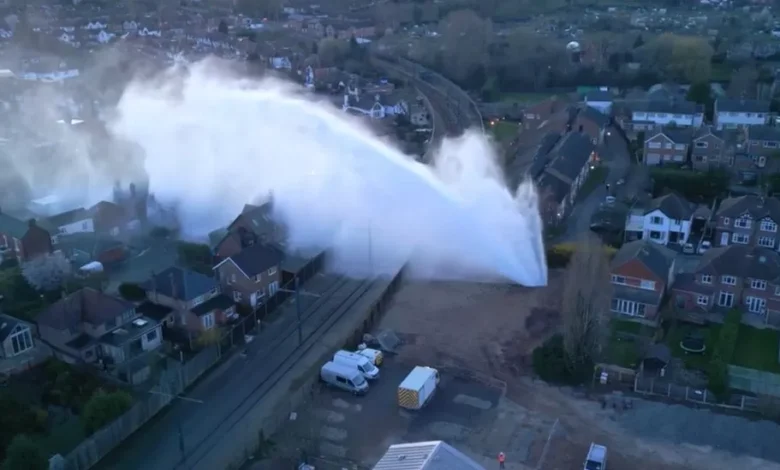
There are currently about 60,000 cases a year of accidental damage to the network, when pipes or cables are struck during a dig.
Those accidents can lead to floods or power cuts, but they also put lives at risk. According to one report by an industry body, an average of 70 people a year are seriously injured as a result of contact with underground electricity cables.
That damage can also mean further disruption and road works, while utility companies make repairs.
Over the last year, the new map – known as the National Underground Asset Register (NUAR) – has been tested in the North East of England.
By 2025, it will include all the underground infrastructure across England, Wales and Northern Ireland.
A similar system already exists in Scotland, and governments are working closely to make sure the whole UK map is compatible.
Currently, this crucial information is held by individual companies and can be complicated and unwieldy to access.
Every time a utility company wants to dig up a site – for any repair, maintenance or upgrade – they have to ask each organisation for its plans. One utility company said that the information could take days to gather.
Chris Chambers, deputy director of the government’s Geospatial Commission, said: “There’s enough pipe and cable buried in the UK to wrap around the planet about 35 times.
“We’re trying to bring it all together, to make it really easily accessible for those people who carry out maintenance and repairs on pieces of critical infrastructure – so they can have [that information] at their fingertips.”
That involves collecting data from more than 700 organisations that own all those buried pipes and cables.

There have been previous attempts to put all this information in one place, but Mr Chambers explained that there were legal, commercial and security challenges that could not be overcome without government involvement.
“It’s a fine balancing act between making data accessible and secure,” he said.
Becky Hunter, area manager from Northumbrian Water, says it will make a “huge difference”.
“We’ve experienced hours of delays getting this information in the past,” she said. “With this, it’s straight on our phone and it’s [there] in seconds.
“That’s so important for the crews on the ground, who are working at these excavation sites.”