Europe’s oldest treasure map, key to unlocking history
An enigmatic slab of rock, containing mysterious markings, was discovered nearly 123 years ago in north-western France. The “Saint-Bélec slab” remained largely untouched and virtually unstudied for 4,000 years until it resurfaced in 2014.
Researchers have since uncovered that it is a “treasure map ” for archaeologists, referring to it as the oldest map in Europe, drawn around the end of the Neolithic era almost 5,000 years ago. This “treasure map “could unlock the secrets of a long-lost kingdom, one that was thought to have collapsed in revolts and rebellions, and could introduce new archaeological sites in Brittany, France, which have never been identified.
Europe’s oldest treasure map, key to unlocking history

(Photo by Fred TANNEAU / AFP)
The French experts are decoding the intricate etchings of the stone slab, piecing together geographical, geological, and human history. They have scanned the stone and investigated the etched bumps and lines, which appear to represent the rivers and mountains of the Roudouallec region, making it something of a treasure map.
They have also discovered a series of pocked hollows, indicating potential discovery sites for further excavation and exploration. However, even with the discovered symbols, experts still have to identify and understand all of the geometric markings and establish the legend behind each of them.
Using the stone map to locate other archaeological features and artifacts presents a new approach to archaeological research, compared to the common use of radar equipment, aerial photography, or chance discoveries of new constructions in cities.
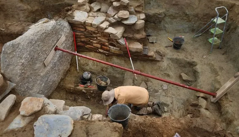
The Saint-Bélec slab covers the area of an ancient kingdom, and the researchers have to survey the entire area to discover all the locations marked on the ancient map fully. The task is colossal and estimated to take up to 15 years.

(Photo by Fred TANNEAU / AFP)
Before the researchers can go on to excavate the rest of the area, they must first examine the burial site where the Saint-Bélec slab was first discovered. The digging and exploration could help researchers date the slab’s origin and offer more clues about the long-lost kingdom that the map has uncovered.
Already, the researchers have uncovered previously undiscovered fragments of the ancient stone slab that had been used for tomb walls, a clear sign of the shifting power dynamics of the Bronze Age settlements.
By decoding the symbols, deciphering the engravings, and studying the historical contexts, researchers could open new possibilities for exploring Brittany’s ancient history. The Saint-Bélec slab has become an essential treasure map for modern archaeologists, potentially leading them to discover the long-lost remnants of an ancient society and exposing a forgotten world of our ancestors.